Course Maps


Course Maps

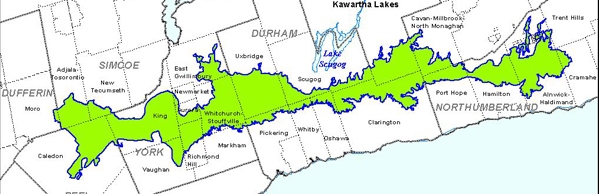
The Full Relay Course will be divided into 14 sections. The Canoe section – the 1st leg of the event - must have 2 team members paddling. The Full Relay Race starts at 8:00 am at Gore's Landing (see course map 1 below). You must arrive between 7:00 am and 7:15 am to register.

The Half Relay course is divided into 7 sections. The Half Relay starts at 1:00 pm at Purple Woods Conservation Area (see course map 8 or 9 below). You must arrive between 12:15 pm and 12:30 pm to register.

Exact course details for each leg along with descriptions of the terrain and route will be provided to teams.


Please note:  There may be minor route changes and every team should check the route ahead of race day.

STAGE


START LOCATION (click to see Google map)


COURSE
MAP
(Click to view**)


FINISH LOCATION


ACTIVITY


DISTANCE
(KM)


Est'd
FINISH
(8 am
START)

1
 

Gore's Landing


1


Bewdley Waterfront


Canoe


8


9:00am-
9:40am

2
 

Bewdley Waterfront


2 & 3


Ganaraska Forest Centre (Cold Springs Camp Rd & 10th Line)


Mtn Bike


18


  9:50am-
11:00am

3
 

Ganaraska Forest Centre


4


Boundary Rd Parking Lot #3
(green ‘P’)


Run/hike


10


10:30am-
12:30pm

4
 

Boundary Rd Parking Lot


4 & 5


Hwys 35 & 115 Junction


Run/hike


6


11:00am-
  1:30pm

5
 

Hwys 35 & 115 Junction


5


Darlington Con. 8 & Darlington-Clarke Townline


Run/hike


9


11:30am-
  2:30pm

6
 

Darlington Con. 8 & Darlington-Clarke Townline


5 & 6


Long Sault Conservation Area Parking Lot


Mtn Bike


10


12:00pm-
  3:15pm

7
 

Long Sault Conservation Area


7 & 8


Purple Woods Conservation Area Parking Lot


Mtn Bike


19


12:30pm-
  4:30pm

8
 

Purple Woods Conservation Area


9 & 10


Houston Rd, & 7 Concession Uxbridge Twp.


Hybrid/Mtn Bike


17.5


1:10pm-
5:30pm

9
 

Houston Rd, & 7 Concession Uxbridge Twp.


10 & 11


Secord Conservation Area Parking Lot Uxbridge Twp.


Run/hike


11.5


2:00pm-
6:45pm

10
 

Secord Conservation Area Parking Lot Uxbridge Twp.


11


Bloomington Rd. & 10th Line


Run/hike


8


3:00pm-
8:45pm

11
 

Bloomington Rd. & 10th Line


12


YRF Hollidge Tract Parking Lot 16430 Hwy 48 Stouffville


Mtn Bike


12


3:30pm-
9:00pm

12
 

YRF Hollidge Tract Parking Lot 16430 Hwy 48 Stouffville


12


McCowan Rd & Jesse Thompson Rd, Stouffville


Run/hike


6.5


4:00pm-
9:30pm

13
 

McCowan Rd & Jesse Thompson Rd, Stouffville


13


Sheppards Bush Conservation Area, Aurora – Parking area


Hybrid/Mtn Bike


15


  4:30pm-
10:30pm

14
 

Sheppards Bush Conservation Area, Aurora


14 & 15


ORTA – Seneca College King Campus 13990 Dufferin St.  King City


Run/hike


10.5


  5:00pm-
11:30pm

Finish Line is the Log Cabin at Seneca College 13990 Dufferin St. King City, ON          


>>>        Download the Driving Directions to Checkpoints

* Stage Maps have been created from Google™ and can be used by competitors and supporters to navigate to the checkpoints by car.
** Course Maps are based on the ORTA Trail Guidebook cartography maps
                         (all maps are in pdf format for easy download & printing)