IMPORTANT NOTICES and MAP UPDATES: ORTA endeavours to notify its members and the public of updates or corrections to edition 7 guidebook (May/21). Please check this site regularly.
York Region Hazard Tree Removal - (March 4, 2024) Be advised that the Region's Hazard Tree Removal contactor will be undertaking work in our Forest Tracts beginning on Monday March 4th 2024. Work will take place in one or two tracts at a time, with signage placed at the main entrance to inform the public. The operation is expected to last up to eight weeks. For the safety of the public and workers please keep clear of the operation. If you have any questions regarding this operation please contact steve.columbus@york.ca.
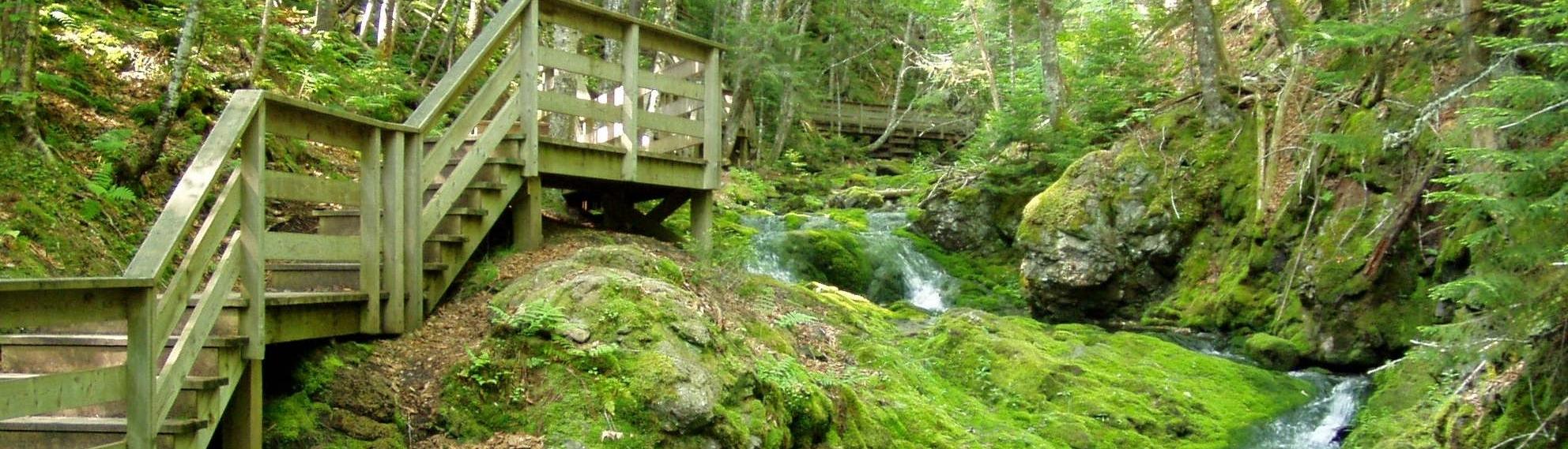
ORTA Map 2 Seneca College Trails Work - (March 4, 2024) Rick Greenlaw reports that they are installing Armor stone and removing sections of the board walk that will be replaced. This section of the trail (L4-1 and L4-2) will be closed or limited access starting later this week and into next week. SEE MAP The approximate completion date and a more detailed work schedule I will have after our construction meeting this week. Based on the weather conditions we have experienced this year the schedule and areas of work we have had to keep fluid (changing) for the frost conditions have not been in our favor.
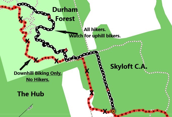
ORTA Map 5 and Map 6 Durham Skyloft Reroutes Update Nov 26, 2023 THUMBNAIL click here
ORTA Map 6 Purple Woods Update July 4, 2023 Route is now apx 1.4km. See new Purple Woods ROUTE here
ORTA Map 7 Murphy Tract Update July 4, 2023 Area is now permanently rerouted. This is to allow for natural regeneration. Route is now apx 1.3km. See map here. See closer detail map here
MAPS 8 & 9. Ganaraska Forest Update May 16, 2023. (a) Ganaraska Forest requires all users to have an individual Forest Pass, even if following the Oak Ridges Moraine Trail. Information & online passes available at: ganaraskaforestcentre.ca Be aware that there is an ongoing process of trail changes and signage / blazing markings. This might have an effect on navigating ORMT route. So, heads up and patience. Please report any issues to ORTA.
ORTA Map 1 UPDATE FEB 22, 2023 East from Palgrave on the Caledon Trailway, we now continue on the Trailway east of Mount Pleasant Rd to Mount Wolfe Rd. It is 2km between the two distant markers. This update takes us more off-road. See map reroute HERE.
ORTA Map 5 UPDATE Jan 10, 2023 The Trail Hub 722 Chalk Lake Rd. Uxbridge, ON L9P 1R4 There is a pay-per-use fee. Currently $6 per person per day. Please visit: https://www.trailhub.ca/index.php/about/pay-per-use-2022.
ORTA MAP 5 UPDATE JULY 24, 2022 Uxbridge Trailhead Parking Revenues to Sustain Trails and Local Amenities. Permit parking is being implemented at all trailheads in the Durham Region Forest area and trail-head along Conc. 6 and 7. Daily parking permits will cost $6.00 per day. All funds collected from parking revenue will be directed towards trail improvements. Frequent users of trail-heads will be able to purchase yearly parking passes for $75, and Township of Uxbridge residents will be able to obtain a permit at no charge by registering on the parking system. Learn more click here
Free Parking in Uxbridge is still available at the following locations:
1- conc. 2.- roadside, future parking lot at the Rouge Park Coyote Trail south of Webb Rd)
2- conc.3-roadside/Goodwood Tract TRCA, parking lot/Secord Forest
3- conc.4- roadside
4- Brock Rd- parking lot/Pleasure Valley/Pathways, parking lot/Brock Tract TRCA.
ORTA MAP 10 UPDATE JULY 12, 2022 Northumberland Forest Map shows R roadside parking at Bowmanton Road west of Beagle Club Rd. This is no longer allowed. Vehicles may be tagged and towed Referencing By Law 21-10.
ORTA MAP 3B UPDATE May 2022 Correction to a Trail Distance Point between Dufferin and Bathurst St. is 2km not 3.8km
Correction to Map 3B Hwy 404 was inadvertently marked as Hwy 400 :
Main Route runs along 18th Sideroad between Concession 10 and 11 and not through landowners property. May 2021 after edition 7 print.
ORTA Map 10 & 11 UPDATE SEPTEMBER 30, 2021 Map 10 Hamilton and Map 11 Northumberland Forest in the new edition 7 guidebook HAD incorrect Trail Distance Points (TDP). If you purchased the guidebook from a retailer and require the corrected map please notify the office by email and a new Map 10 and 11 will be mailed to you at no additional cost. (info@oakridgestrail.org) . The correct maps have 2021 in the bottom corner.